


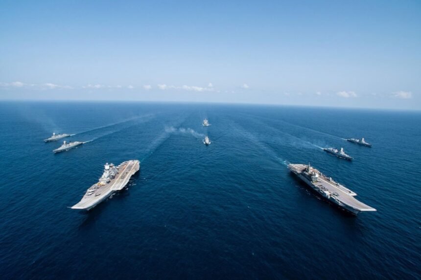
Why Indian Ocean is a Central point of the globe?
The Indian Ocean Region (IOR) represents approximately 20 percent of the world’s water surface, stretching from Africa’s eastern coast to Australia’s western shores and the Malay Peninsula. Modern maritime doctrine now treats the IOR as a single, continuous strategic theater extending from the Strait of Hormuz to the Malacca Strait a critical shift from historical continental sub region approaches.
- Why Indian Ocean is a Central point of the globe?
- Why the Indian Ocean Matters for Global Trade?
- Critical Maritime Chokepoints:
- Historical Strategic Depth
- China’s Malacca Dilemma and the Economics of Maritime Vulnerability
- The Scale of China’s vulnerability
- How a maritime blockade works (Without entering Malacca)
- China’s Belt and Road Initiative: Overland bypass routes
- Why overland bypasses cannot Eliminate Maritime Vulnerability
- The Andaman and Nicobar Islands: India’s Unsinkable Strategic Anchor
- Geographic Positioning: The Strategic Sweet Spot
- The Great Nicobar Island Development Project (GNIDP)
- Project Components and Strategic Objectives
- Andaman and Nicobar Command (ANC): India’s Tri-Services Theater Command
- Naval Warfare Perspective: The Unsinkable Aircraft Carrier
- Quad vs. China: The Escalating Great-Power Competition in the IOR
- The Indo-Pacific Integration: One Strategic Theater
- China’s “String of Pearls” Strategy and Civil-Military Fusion
- Quad Response: Free and Open Indo-Pacific
- Foreign Basing Architecture and Power Projection
- Key Foreign Military Installations
- Diego Garcia: The Cornerstone of Western Power Projection
- Vulnerability of Isolated Island Outposts: The March 2026 Iran War
- India’s Expanding Maritime Footprint
- The India-Indonesia Friendship: Guarding the Malacca Gateway
- Geographic Convergence at the Malacca Gateway
- Concrete Bilateral Defense and Infrastructure Initiatives
- 1. Joint Sabang Port Development
- 2. Framework on Maritime Safety and Security
- 3. Integrated Chokepoint Coverage
- Strategic Implications for Chinese Maritime Strategy
- Macroeconomic Fallout of an Indian Ocean Conflict
- (1) Primary Disruption Mechanism: Chokepoint Closure
- (2) Operational Inefficiencies from African Rerouting
- (3) Extended Transit Durations
- (4) Extreme Freight Inflation
- (5)Global Container Displacements
- (6)Insurance Market Systemic Shock
- (7) Global Economic Impact
- India’s Advantages and Strategic Supremacy in the IOR
- Central Geographic Positioning: The Immovable Center
- Dual Island Fortress Architecture
- Eastern Fortification (Bay of Bengal)
- Western Fortification (Arabian Sea)
- SAGAR Policy: India as Net Security Provider
- The Operational Environment
- Conclusion:
Why the Indian Ocean Matters for Global Trade?
The geopolitical importance of this ocean domain stems directly from its central role in global commercial transit and energy security:
- Over one-third of the world’s bulk cargo traffic transits the IOR.
- Two-thirds of all seaborne petroleum shipments pass through Indian Ocean waters.
- Critical access to energy reserves, raw minerals, and industrial inputs depends on these sea lanes.
This concentration of global trade creates a fundamental vulnerability: any systematic blockade, regional instability, or militarized conflict within the Indian Ocean immediately spreads across international markets, disrupting global supply chains and creating sharp inflationary pressure worldwide.
Critical Maritime Chokepoints:
The defining geographic feature of the IOR is its heavy reliance on narrow maritime chokepoints and access channels. More than 80 percent of the world’s seaborne crude oil trade passes through Indian Ocean maritime bottlenecks:
| Chokepoint / Access Passage | Key Connecting Zones | Major Trade / Energy Flows | Strategic Risk Profile |
|---|---|---|---|
| Strait of Hormuz | Persian Gulf to Arabian Sea / Western IOR | ~40% of global seaborne oil exports | Extreme; vulnerable to regional state conflict, naval interdiction, and sea-mine deployment |
| Strait of Malacca | Andaman Sea / Bay of Bengal to South China Sea | ~35% of global oil trade; ~30% of global commercial shipping | High congestion; susceptible to distant naval blockades and entry-channel surveillance |
| Bab el-Mandeb Strait | Red Sea / Suez Canal access to Gulf of Aden | ~8% of global seaborne oil; major East-West container trade | High; exposed to asymmetric missile/drone strikes, piracy, and regional proxy warfare |
| Six / Ten Degree Channels | Andaman Sea and Bay of Bengal transit vectors | Primary trade lanes exiting the Malacca Strait | High strategic leverage; commanded by forward island fortifications |
| Eight / Nine Degree Channels | Arabian Sea / Western IOR trade corridors | Crucial SLOCs linking Hormuz/Europe to East Asia | Moderate-High; vulnerable to subsurface, surface, and air surveillance nodes |
Historical Strategic Depth
In major historic global conflicts, control over the Indian Ocean provided essential strategic depth, allowing powers to project force across surrounding continental landmasses. In contemporary geopolitics, the extreme dependence of major East Asian economies most notably China, Japan, and South Korea on energy shipments transiting the IOR makes the ocean the primary structural lever for power projection and economic coercion in the Indo-Pacific.
China’s Malacca Dilemma and the Economics of Maritime Vulnerability
The geopolitical strategy of the People’s Republic of China (PRC) in the Indian Ocean is largely defined by the “Malacca Dilemma” a fundamental security vulnerability originally articulated by Chinese leadership in 2003.
The Scale of China’s vulnerability
Roughly 80 percent of China’s total imported crude oil supply transits the Indian Ocean and flows through the narrow neck of the Strait of Malacca. This structural concentration creates a severe vulnerability: in the event of a major geopolitical crisis or militarized conflict with a rival naval power, Beijing faces the distinct prospect of an effective distant maritime blockade.
How a maritime blockade works (Without entering Malacca)
Executing a maritime blockade against Chinese trade does not require naval forces to maneuver within the narrow, shallow, and heavily congested waters of the Malacca Strait itself. Instead, hostile naval forces can establish an interdiction posture at the western approaches to the strait:
- Six Degree and Ten Degree Channels passing through India’s Andaman and Nicobar archipelago.
- Deep-water Indonesian archipelagic straits: Sunda, Lombok, and Makassar.
Because deep-draft commercial oil tankers (VLCCs) require specific depth profiles for navigation, diverting shipping around Australia adds thousands of nautical miles, extending voyage times by weeks and dramatically increasing fuel and insurance costs to economically unsustainable levels.
China’s Belt and Road Initiative: Overland bypass routes
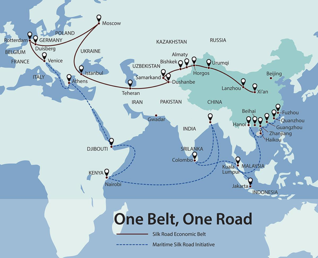
To counter this strategic vulnerability, Beijing has invested heavily in overland and maritime bypass routes under the Belt and Road Initiative (BRI). Key infrastructure projects include:
- Continental energy pipelines running through Central Asia and Russia.
- China-Myanmar Economic Corridor (CMEC) terminating at the deep-water port of Kyaukpyu on the Bay of Bengal.
- China-Pakistan Economic Corridor (CPEC) terminating at Gwadar on the Arabian Sea.
- Kra Isthmus canal proposals across southern Thailand to bypass Malacca entirely.
Why overland bypasses cannot Eliminate Maritime Vulnerability
Despite these massive infrastructure investments, overland bypass corridors cannot eliminate China’s maritime vulnerability due to operational constraints:
| Constraint | Explanation |
|---|---|
| Limited Capacity | Pipeline networks and land transport channels possess only a fraction of the daily volume capacity provided by maritime supertankers |
| Fixed Target Vulnerability | Static land infrastructure, oil terminals, and overland transport corridors remain fixed, highly visible targets vulnerable to long-range precision strikes or regional sabotage during conflict |
| Maritime Termination Points | Deep-water port terminals in third-party nations (Myanmar, Pakistan) still terminate in maritime environments easily monitored and interdicted by hostile carrier strike groups and nuclear attack submarines (SSNs) operating in the open Indian Ocean |
Overland bypasses serve as supplementary supply lines rather than replacements for seaborne trade, ensuring that the Malacca Dilemma remains a major operational vulnerability for Chinese strategic planners.
The Andaman and Nicobar Islands: India’s Unsinkable Strategic Anchor
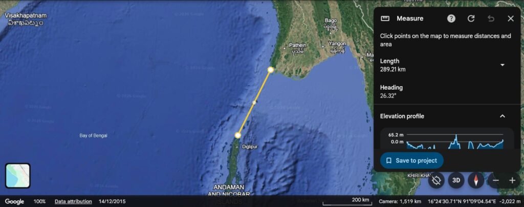
Located at the junction of the Bay of Bengal and the Andaman Sea, the Andaman and Nicobar Islands give India a decisive geographic advantage in the eastern Indian Ocean.
Geographic Positioning: The Strategic Sweet Spot
This 800-kilometer-long island chain sits directly adjacent to the main international shipping channels exiting the Strait of Malacca:
- Bifurcates the Bay of Bengal from the Andaman Sea.
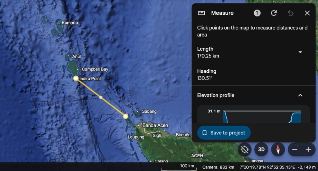
- Great Nicobar Island (southernmost point) lies just 40 nautical miles (74 km) from the entrance to the Malacca Strait.
- Approximately 80 to 90 nautical miles from Rondo Island in Indonesia’s Aceh province.
The Great Nicobar Island Development Project (GNIDP)
To fully leverage this geography, India is executing the Great Nicobar Island Development Project, a multi-sector infrastructure initiative budgeted between ₹72,000 crore and ₹81,000 crore ($8.5 billion to $9.4 billion). Managed by the Andaman and Nicobar Islands Integrated Development Corporation (ANIIDC), the project transforms Great Nicobar into a dual-use economic and military asset.
Project Components and Strategic Objectives
| Component | Technical / Capacity Specifications | Strategic & Military Objective |
|---|---|---|
| Galathea Bay ICTT | 14.2 to 16 Million TEU capacity; >20-meter natural deep-water berth | Captures international transshipment trade; eliminates reliance on foreign ports (Colombo, Singapore); functions as deep-water naval logistics hub |
| Campbell Bay Airport | Greenfield International Airport; 3 km dual-use runway; 4,000 Peak Hour Passengers | Accommodates heavy civilian transports, long-range maritime patrol aircraft (P-8I Poseidon), and front-line combat jets |
| Power Infrastructure | 450 MVA integrated gas and solar power generation plant | Establishes complete energy self-sufficiency for military installations and civilian infrastructure during conflict-driven blockades |
| Township & Base | 16,610 hectares planned urban footprint; logistics and support facilities | Sustains permanent defense personnel, logistics facilities, and advanced electronic surveillance nodes commanding the Six Degree Channel |
Andaman and Nicobar Command (ANC): India’s Tri-Services Theater Command
Military command over the archipelago is centered around the Andaman and Nicobar Command (ANC), established in 2001 as India’s first unified tri-services theater command integrating army, navy, air force, and coast guard assets under a single operational commander at Port Blair.
Forward Operating Facilities:
- INS Baaz at Campbell Bay provides continuous Intelligence, Surveillance, and Reconnaissance (ISR) coverage over the Six and Ten Degree Channels.
Naval Warfare Perspective: The Unsinkable Aircraft Carrier
From a naval warfare perspective, the island chain functions as a permanent, unsinkable aircraft carrier and Anti-Submarine Warfare (ASW) barrier. Indian naval forces operating from these bases can:
- Monitor, track, and intercept Peoples Liberation Army Navy (PLAN) surface ships.
- Detect subsurface vessels entering the Bay of Bengal long before they can reach the open waters of the central Indian Ocean.
Quad vs. China: The Escalating Great-Power Competition in the IOR
The security architecture of the Indian Ocean is increasingly defined by the systemic competition between China and the Quadrilateral Security Dialogue (Quad) comprising India, the United States, Japan, and Australia.
The Indo-Pacific Integration: One Strategic Theater
Historically, Western defense planning treated the Indian Ocean and the Pacific Ocean as separate strategic theaters. However, the formal adoption of the “Indo-Pacific” policy framework reflects the integration of these two oceans into a single competitive arena.
China’s “String of Pearls” Strategy and Civil-Military Fusion
China’s force projection into the IOR relies on its “String of Pearls” strategy and civil military fusion. Beijing has secured:
- Long-term access, port development rights, and logistics facilities across key littoral nations
- Strategic locations include:
- Djibouti in the Horn of Africa.
- Gwadar in Pakistan.
- Hambantota in Sri Lanka.
- Kyaukpyu in Myanmar.
While presented as commercial investments under the Belt and Road Initiative, these deep water port facilities possess structural features such as heavy-load berths, extensive fuel storage, and exclusive administrative zones that enable rapid support for PLAN naval deployments.
Quad Response: Free and Open Indo-Pacific
In response, the Quad partners focus on maintaining a “Free and Open Indo-Pacific” through:
- Enhanced Maritime Domain Awareness (MDA)
- Joint exercises (such as Exercise Malabar)
- Intelligence-sharing networks
Strategic Counterweight: For the Quad alliance, maintaining naval dominance in the Indian Ocean provides a strategic counterweight. If China achieves localized naval dominance in the Western Pacific (e.g., around Taiwan or the South China Sea), the Indian Ocean offers the Quad a leverage point where China’s energy lifelines and commercial supply routes remain exposed to interdiction.
Foreign Basing Architecture and Power Projection
The central and peripheral reaches of the Indian Ocean feature a network of foreign military bases that provide strategic depth and power projection capabilities for both resident and extra-regional powers.
Key Foreign Military Installations
| Installation / Location | Sovereign / Operating Authority | Key Infrastructure & Capabilities | Strategic Operational Utility |
|---|---|---|---|
| Diego Garcia (Chagos Archipelago) | United Kingdom / United States | Joint US-UK base; 12,000 ft runway; deep-water lagoon anchorage; pre-positioned military stocks | Hub for long-range bomber operations (B-52, B-2), carrier strike group support, and middle-ocean power projection |
| Agal駧a Island (Mauritius) | Mauritius / India | Jointly developed 3,000-meter paved military runway; specialized deep-water jetty facilities | Expands Indian Navy maritime air patrol reach (P-8I) across South-Western Indian Ocean and Mozambique Channel |
| INS Jatayu (Minicoy, Lakshadweep) | India | Upgraded naval base; dual-use military/civilian airfield; INAS 334 (MH-60R Seahawk) integration | Guards Nine and Eight Degree Channels; monitors western approaches to India and northern Maldives corridor |
| Doraleh Support Base (Djibouti) | China (PLA) | PLA’s first overseas military base; fortified perimeter; deep-water naval berth facilities | Supports PLAN anti-piracy escorts, regional intelligence collection, and Western IOR presence near Bab el-Mandeb |
Diego Garcia: The Cornerstone of Western Power Projection
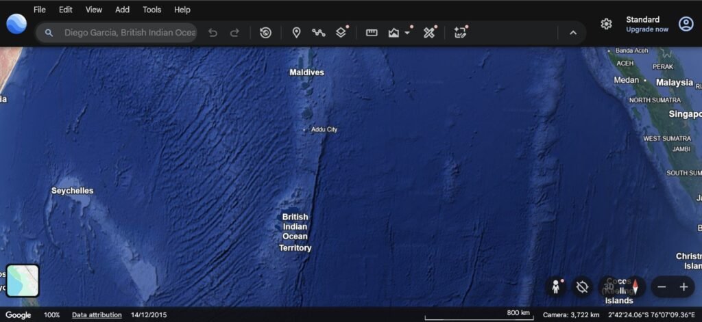
The cornerstone of Western power projection in the center of the IOR is Diego Garcia, the largest atoll in the Chagos Archipelago.
Historical Context:
- Established under a 1966 bilateral agreement between the United Kingdom and the United States
- Followed the forced displacement of the Chagossian population
- Serves as an unassailable logistics hub
Operational History:
Diego Garcia supported extensive air strike and naval operations during:
- 1991 Persian Gulf War
- 2001 war in Afghanistan
- 2003 Iraq War
- Continues supporting operational missions across the Middle East and South Asia
The legal status and long-term security profile of Diego Garcia have evolved:
- Following rulings by the International Court of Justice and international tribunals, a formal treaty was negotiated to transfer sovereignty over the Chagos Islands from the UK to Mauritius
- The treaty secured a 99-year lease back for the Diego Garcia military base
Vulnerability of Isolated Island Outposts: The March 2026 Iran War
Simultaneously, long range strike developments have highlighted the physical exposure of isolated island outposts:
March 2026 Incident:
- During the 2026 Iran War, Diego Garcia was targeted by two Iranian intermediate-range ballistic missiles (IRBMs)
- Fired from approximately 2,350 miles (3,782 km) away
- Attack was unsuccessful, but demonstrated that long-range precision missile technology can extend strike risks to previously isolated mid-ocean bases
India’s Expanding Maritime Footprint
In parallel, India has systematically expanded its own maritime footprint across key island nations:
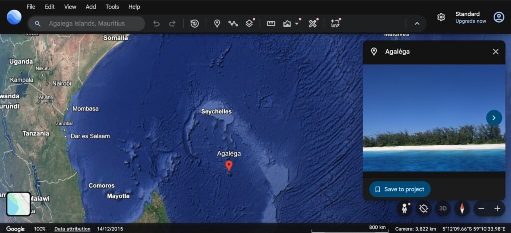
Agalega Island (Mauritius):
- Construction of a 3,000-meter military-grade airstrip and deep-water jetty
- Allows the Indian Navy to conduct continuous long-range anti-submarine patrols across the South-Western Indian Ocean
- Counterbalances PLAN surface and subsurface deployments near Southern Africa
The India-Indonesia Friendship: Guarding the Malacca Gateway
A critical maritime alignment in the eastern Indian Ocean is the strategic relationship between India and Indonesia.
Geographic Convergence at the Malacca Gateway
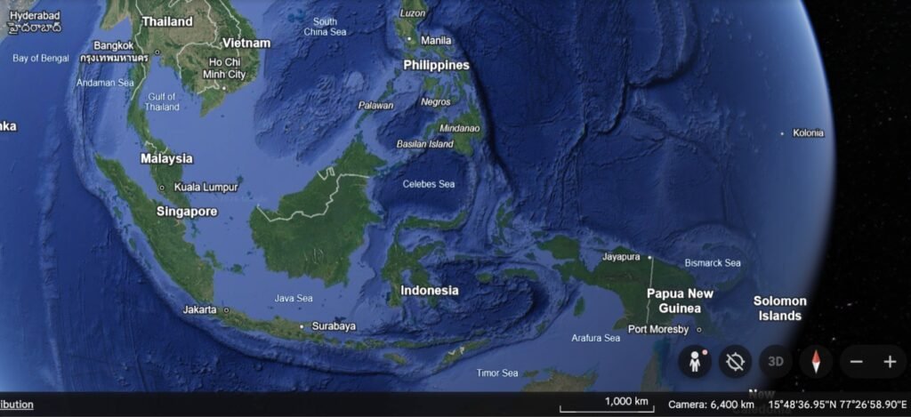
The geography of the two nations converges directly at the western entrance to the Malacca Strait:
- Indira Point on Great Nicobar Island is situated merely 145 kilometers (80 nautical miles) from Rondo Island in Indonesia’s Aceh province
- This physical proximity positions New Delhi and Jakarta as joint custodians of the primary maritime gateway connecting the Indian and Pacific Oceans
Concrete Bilateral Defense and Infrastructure Initiatives
Strategic alignment between the two nations has consolidated through concrete bilateral defense and infrastructure initiatives:
1. Joint Sabang Port Development
- India and Indonesia are collaborating on the infrastructure development of Sabang deep-sea port
- Located at the northern tip of Sumatra
- Provides a natural deep-water harbor overlooking the western mouth of the Malacca Strait
2. Framework on Maritime Safety and Security
- High-level bilateral agreements facilitate:
- Coordinated naval patrols (CORPAT)
- Continuous maritime data exchange
- Joint intelligence monitoring over archipelagic transit corridors
3. Integrated Chokepoint Coverage
- The physical pairing of Great Nicobar’s military infrastructure with Indonesia’s Sabang port creates a strategic barrier across the Six Degree Channel
Strategic Implications for Chinese Maritime Strategy
For Chinese maritime strategists, an aligned India-Indonesia partnership represents a serious operational complication:
- Indonesian control over archipelagic sea lanes (including the Sunda, Lombok, and Makassar straits)
- Combined with India’s forward military deployment in the Andaman and Nicobar Islands
- Result: Every deep-water transit route linking the Indian Ocean to East Asia is flanked by cooperative regional powers
This alignment significantly restricts the ability of PLAN surface warships and attack submarines to enter or exit the Indian Ocean undetected.
Macroeconomic Fallout of an Indian Ocean Conflict
If localized naval tensions in the Indian Ocean escalate into active war zone conditions, the resulting disruption to global trade would trigger immediate shocks across the international economy.
(1) Primary Disruption Mechanism: Chokepoint Closure
The primary mechanism of economic disruption would be the immediate closure or operational paralysis of key chokepoints, particularly:
- Straits of Malacca
- Strait of Hormuz
- Bab el-Mandeb
Shipping lines would be forced to abandon direct East-West trade routes through the Suez Canal and Malacca Strait, rerouting container ships and bulk carriers around the Cape of Good Hope at the southern tip of Africa.
(2) Operational Inefficiencies from African Rerouting
Rerouting global maritime traffic around Africa introduces severe operational inefficiencies across global supply chains:
(3) Extended Transit Durations
- Rerouting around the African continent adds 10 to 14 days to standard voyages between East Asia and Western Europe
- Disrupts factory production schedules and retail supply chains
(4) Extreme Freight Inflation
- Longer transit distances increase bunker fuel consumption by 30 to 40 percent per voyage
- Drives up:
- Container shipping rates
- Spot charter prices
- Final consumer goods costs
(5)Global Container Displacements
- Commercial vessels locked in longer transits cause:
- Acute container shortages at major export hubs in East Asia
- Severe congestion at receiving European and North American ports
(6)Insurance Market Systemic Shock
Simultaneously, the commercial maritime insurance market would experience systemic shock:
- War-risk insurance premiums for cargo vessels entering the Indian Ocean would spike or be revoked entirely by major international underwriters
- Effectively grounding commercial shipping even in non-combat zones
(7) Global Economic Impact
Because two-thirds of global seaborne petroleum and one-third of bulk cargo transit the IOR, a prolonged naval conflict would trigger:
- Severe global energy price spikes
- Cascading stagflation across industrial nations
- Acute supply shortages of food and agricultural inputs in developing nations dependent on imported grain and fertilizers
India’s Advantages and Strategic Supremacy in the IOR
Although China maintains numerical superiority in overall naval combatants and total tonnage, the Republic of India holds a commanding geographic and operational advantage within the Indian Ocean theater.
Central Geographic Positioning: The Immovable Center
India’s primary strategic advantage rests on its central geographic positioning:
- The Indian peninsula extends over 2,000 kilometers into the ocean
- Supported by a 7,500 kilometer coastline
- Places approximately 50 percent of the entire IOR within a 1,000-mile operational radius of Indian territory
This geography functions as an immovable center of operations, allowing the Indian Armed Forces to deploy along short, internal supply lines, whereas extra-regional powers must maintain forces across extended, vulnerable supply lines thousands of miles from home ports.
Dual Island Fortress Architecture
India has reinforced this geographic advantage by establishing a dual-flank island fortress architecture across its oceanic territories:
Eastern Fortification (Bay of Bengal)
- Andaman and Nicobar Command commands the western entrance to the Malacca Strait
- Base facilities such as INS Baaz and the Galathea Bay ICTT development provide:
- Continuous sensor coverage
- Rapid-response strike capabilities over the Six Degree and Ten Degree Channels
Western Fortification (Arabian Sea)
- March 2024: India commissioned INS Jatayu on Minicoy Island—the southernmost atoll of the Lakshadweep archipelago
- Marks India’s second fully equipped naval base in the chain alongside INS Dweeprakshak in Kavaratti
- Strategic Position: Situated near the Maldives, INS Jatayu sits directly astride:
- Eight Degree Channel (separating Minicoy from the Maldives)
- Nine Degree Channel
- Capabilities:
- MH-60R Seahawk ASW helicopter squadrons (INAS 334)
- Expanding airfield infrastructure
- Allows India to monitor maritime traffic flowing from the Persian Gulf and Red Sea toward East Asia
SAGAR Policy: India as Net Security Provider
Supplementing this domestic base infrastructure is India’s role as a net security provider under its SAGAR (Security and Growth for All in the Region) policy framework.
Institutionalized Security Partnerships:
| Partner Nation | Defense Infrastructure Agreement |
|---|---|
| Mauritius | $100 million defense line of credit; joint construction of military airstrip facilities on Agal駧a Island |
| Maldives | $50 million in defense assistance to support coast guard infrastructure |
| Sri Lanka | Joint Maritime Rescue Coordination Center (MRCC) to integrate regional domain awareness |
The Operational Environment
This combined network creates an asymmetric operational environment:
In any potential conflict within the IOR:
- External naval fleets (such as China’s PLAN) must:
- Operate at the end of long logistical supply lines
- Remain exposed to continuous monitoring by India’s island-based sensors
- Face rapid interdiction by land-based strike aircraft and naval assets operating near domestic support bases
Conclusion:
The history tells us “Whoever wins the Ocen wins the Globe”. Currently everyone is pushing their best to have control over the IOR but the real controller are always the regional players as we saw in Iran conflict. However, it looks like the next possible battle is not much far from us but the globle leaders and strategist always thinks beyound our level.